

GTA Vice City in real life: what the Miami of the 2002 map looks like today
For many people, Miami didn’t first appear in a travel guide: it appeared on the map of GTA: Vice City. Ocean Beach, Vice Point, Downtown, Little Havana and the islands in the bay made up a fictional city that felt real even though you could cross it in minutes. In this guide I go back to that 2002 map district by district, tell you which parts of Miami its places evoke and suggest a route to spot the inspiration without forcing exact matches where there are none.
As a Grand Theft Auto fan, Miami will always have an extra layer for me: the map of GTA: Vice City. This article goes with our guide to GTA 6 and the real places and focuses on the 2002 game, its districts and the city that inspired them. I’ve checked the map and the official manual against Miami and Miami-Dade sources, consulted on November 18, 2026. Some accommodation, tour and mobile data links are affiliate links: Youtopia may earn a commission if you book, at no extra cost to you.
This is the classic Vice City. The new stuff (Leonida, the trailers, the Everglades, the Keys) and the practical side of the trip are in Vice City is real: the GTA 6 places you can visit.
The Vice City map: an invented Miami made for driving
Vice City isn’t Miami with another name. It’s a fictional city, compact and exaggerated, with islands, bridges, a beach, a port, residential neighborhoods and a financial district. The map of the 2002 game lays out areas like Ocean Beach, Washington Beach, Vice Point, Downtown, Little Havana, Little Haiti, Prawn Island, Starfish Island, Leaf Links and Viceport. Rockstar built a place you recognize by its inspiration, but it rearranged distances, streets and coastlines so it would work as a game world.
That map is still useful for planning a real themed route if you use it as a visual compass. It won’t give you current addresses: it helps you organize a visit by atmosphere. Beach and Art Deco on one side; cultural neighborhoods west of downtown; the skyline and the port by the bay; residential islands and golf courses you look at from public places. For the names and locations of the game’s districts, check the official Vice City manual and its map, not fan maps without a legend.
| Vice City district | Real area it evokes | A stop you can visit |
|---|---|---|
| Ocean Beach | South Beach and its waterfront. | Ocean Drive, the Art Deco district and Lummus Park. |
| Washington Beach | The urban coast of Miami Beach. | Washington Avenue and the inner streets of South Beach. |
| Vice Point | The beach strip toward Mid Beach and further north. | Keep going along Miami Beach; the match is one of atmosphere. |
| Downtown | Miami’s real downtown. | Metromover, Bayside and the bayfront walk. |
| Little Havana | Calle Ocho and the Cuban American community. | Máximo Gómez Park, the Walk of Fame and murals. |
| Little Haiti | Little Haiti, north of downtown. | Look for cultural spaces and check connections before you go. |
| Viceport | The port and terminals of PortMiami. | See it from a public tour; don’t enter restricted areas. |
| Starfish Island | The image of the bay’s private islands and mansions. | Take in the view from an authorized boat trip. |
| Prawn Island and Leaf Links | Fictional islands with studios and golf courses. | There’s no single tourist equivalent; enjoy the view of the bay. |
Ocean Beach: the Miami of neon, hotels and the oceanfront
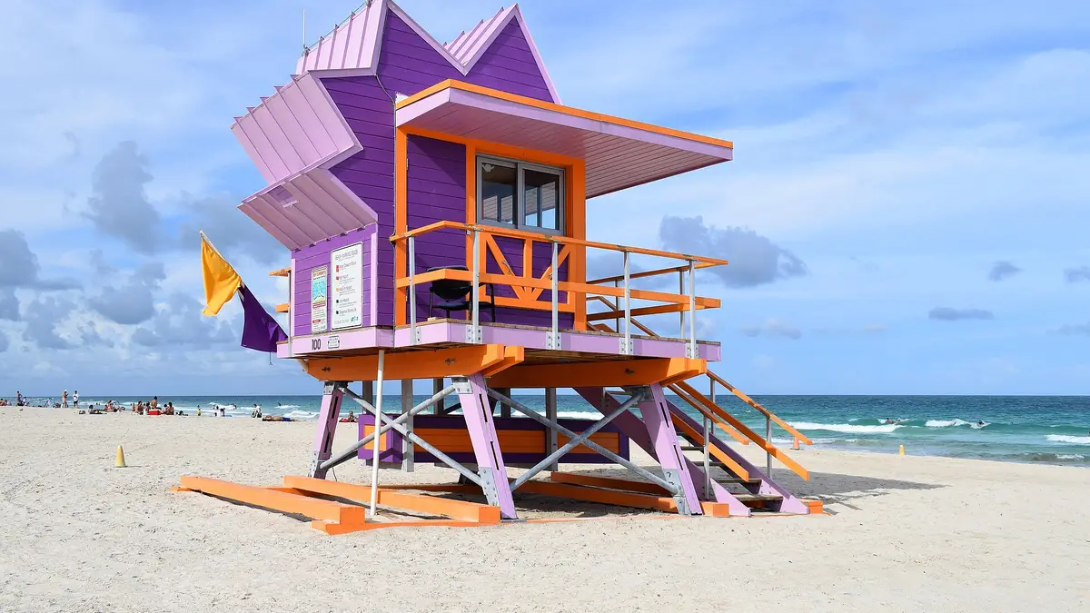
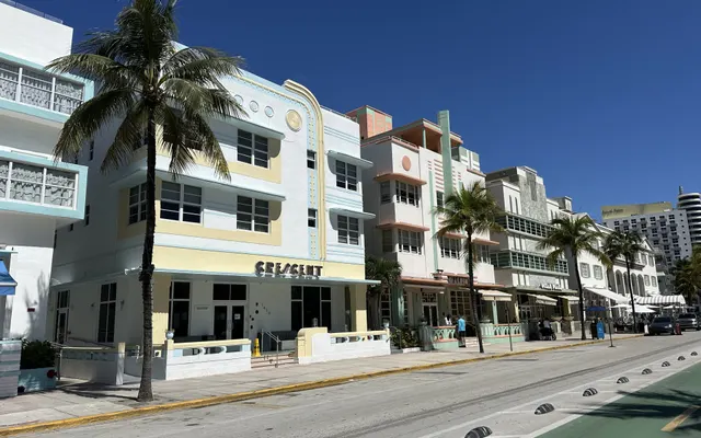
Ocean Beach is the part of the classic map that usually comes to mind first when you think of Miami: low-rise hotels, pale facades, neon, palm trees and an avenue by the sea. To get close to that feeling, start with Ocean Drive in South Beach. The Miami Beach Art Deco district runs roughly between 5th and 23rd Streets, along Ocean Drive, Collins Avenue and Washington Avenue. The official local tourism guide gathers the area’s buildings, walks and sights.
Don’t look for a specific building from the game expecting to find it with the same color or name. In Vice City, Rockstar stylizes the whole; in the real Miami, look at the round windows, the curved lines, the awnings, the marquees and the way street, park and beach connect. The Art Deco Historic District has its own architectural history, and the Miami Design Preservation League tours help you read it with more context.
Do the walk on foot and leave time to wander down the inner streets. Lummus Park runs alongside the beach; to the south, South Pointe Park opens up views of the bay and the boats. At night, Ocean Drive adds lights and atmosphere, but plan your way back, stay in public spaces and don’t stop in bike lanes or on the road to recreate a scene. The street may look like a postcard; it’s still a road with traffic.
What to see if you only have a few hours in South Beach
- Start at the Art Deco Welcome Center. Check beforehand whether it’s open and which tours run that day.
- Walk Ocean Drive. Look at the facades and then cross to Lummus Park to see the beach.
- Come back along Collins or Washington Avenue. That way you don’t repeat the same stretch and you see the inner streets.
- If you have time left, head down to South Pointe. Add the park and the bay views without entering private property.
Washington Beach and Vice Point: following the coast beyond the postcard
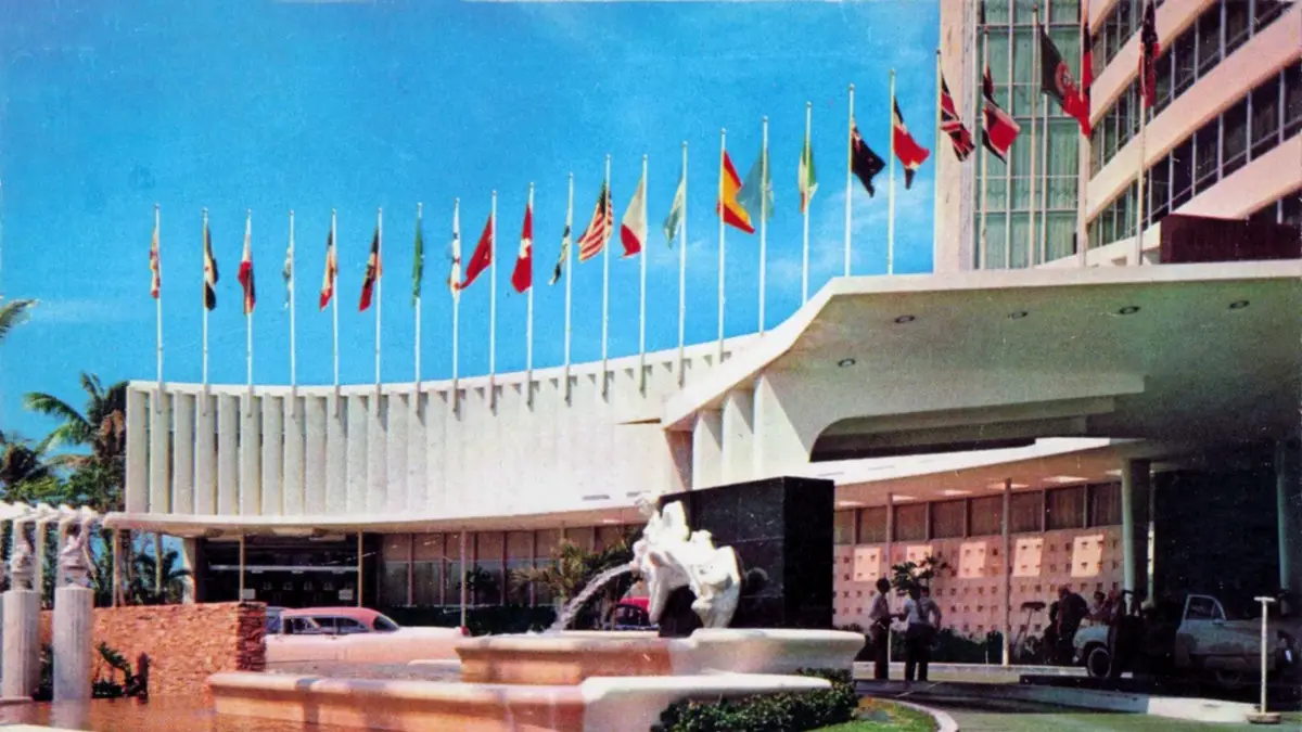
Washington Beach and Vice Point are fictional districts on the 2002 map. They give the game more coastline than Ocean Beach alone; on a real visit, you can continue north along Miami Beach and compare South Beach with Mid Beach. There’s no official line saying Vice Point equals a specific block. It’s more honest to think of an urban beach strip with hotels, avenues and residential buildings.
The beach is one of the best free parts of the trip, but check local rules, safety flags, access points, showers and temporary closures. Bring water and sun protection, even if the day is cloudy. If someone in the group wants to swim and another prefers architecture, you can split up for an hour and meet at a visible spot, instead of squeezing everyone into a single activity.
Downtown and Viceport: the city skyline and the port
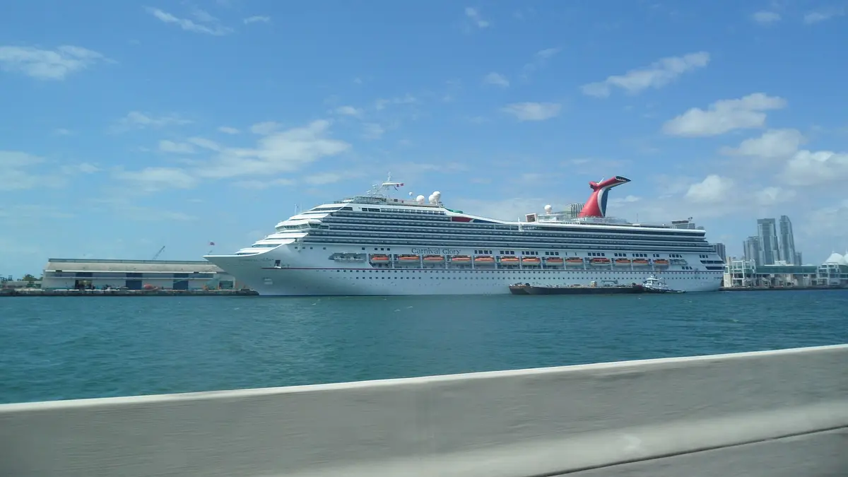
Vice City’s Downtown represents the vertical center: skyscrapers, offices, highways and the bay. In the real Miami, the elevated Metromover connects parts of Downtown and Brickell, and it’s free. From the car you see how the scenery changes between avenues, buildings and water. Check the current stations and county notices; the route helps you explore downtown, it doesn’t replace trips to Miami Beach, Wynwood or the Everglades.
Bayside Marketplace and the waterfront are good reference points for getting your bearings and finding boat trips. PortMiami is on Dodge Island, right next to downtown, but the operating terminals and docks have controlled access. Don’t follow a route from the game up to a real gate or try to get in for photos. If you want to see the port and the islands, choose a trip with public boarding and confirm exactly where it goes.
This part of the city pairs well with the Pérez Art Museum Miami and Frost Science, both facing the bay. Check tickets, exhibitions and opening hours on their websites before booking. If you’re traveling with people who don’t play, including a museum or a walk can balance the itinerary: not every stop has to be a nod to GTA for the day to work.
Little Havana: back to the neighborhood the game called Little Havana
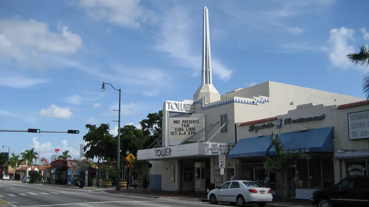
Little Havana is one of the names the game borrowed from the real city, although the digital neighborhood and the real one don’t share an exact layout. Calle Ocho, Southwest 8th Street, is packed with cafés, shops, murals, music and community spaces. Máximo Gómez Park, known as Domino Park, is a local meeting place. The Calle Ocho tourist guide recommends starting at the visitor center and exploring the neighborhood on foot.
In Vice City, Little Havana appears as a district you can explore between missions and fictional shops. In the real Miami, Cuban and Latin American history isn’t a backdrop: it’s the daily life of the place. Stroll the Walk of Fame, look at the murals and, if you’re into history, look for Cuban Memorial Boulevard and the cultural spaces. Go with curiosity, not with the idea that the people who live there are part of your themed visit.
The park invites you to watch domino games from the benches, but respect the players and don’t photograph anyone up close without permission. Games may be reserved for members; visit as a spectator and don’t interrupt. If you want a food stop, there are plenty of options in the area, but I’m not going to make up a personal recommendation or declare a restaurant «the authentic one»: choose by menu, current prices and what you feel like.
Calle Ocho combines well with a walk past nearby murals and monuments. Ask at the visitor center about events and tours when you arrive, because Cultural Fridays and other events depend on the calendar. If you prefer a guided visit, check whether the tour focuses on history, food or art and whether it includes tastings; the words «Cuban tour» don’t mean everyone visits the same places.
Little Haiti, Prawn Island and the places with no exact equivalent
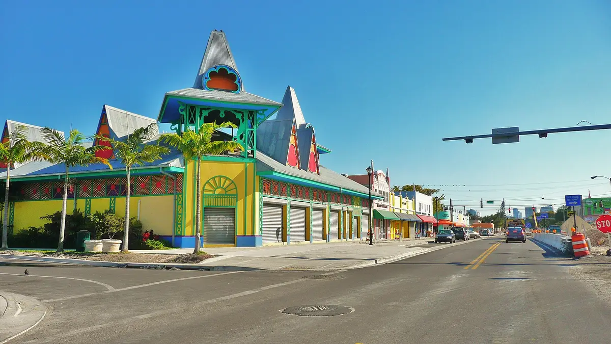
Little Haiti exists on the real map and in Vice City too, but its edges, shops and streets in the game are an interpretation. North of downtown, the real neighborhood has communities and cultural spaces that deserve a respectful visit. Check the places you’re interested in and the transport before you go, because it isn’t a walkable extension of South Beach. If you don’t have a specific activity in mind, there’s no need to add it just to tick off a name from the map.
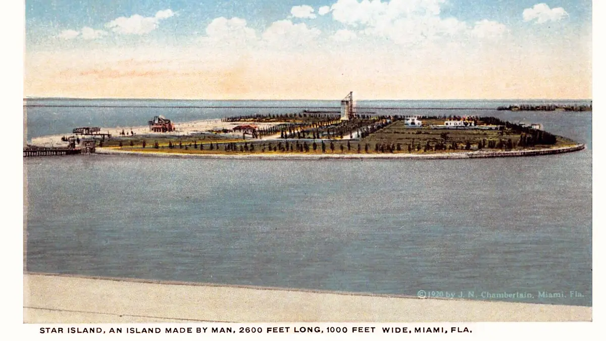
Prawn Island, Leaf Links and other invented areas serve game purposes: studios, golf, mansions and missions. Miami’s bay does have islands and private residences, but that doesn’t make them open attractions. You can admire the scenery from viewpoints and authorized boat trips. Don’t land on private property or hunt for a map point among fences, service docks or residential streets.
That difference between «inspired by» and «you can visit» matters for planning well. The game mixes architecture and geography and can put features that are far apart in the real city on a single block. A fan map can be a list of clues, but double-check it before turning it into a route, especially if it assumes a home, a club or a port are public spaces.
The 1980s Miami behind the Vice City vibe
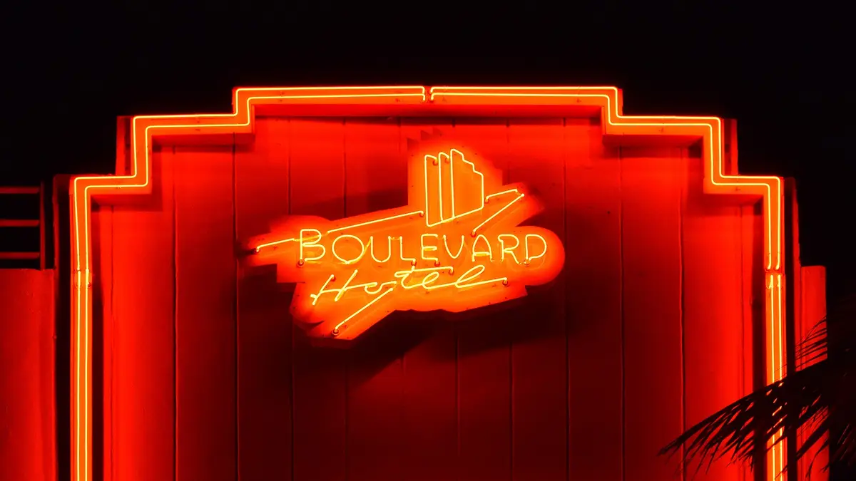
Vice City popularized an image of Miami tied to neon, cars, beaches, palm trees and music. The game isn’t a documentary about the city, but its look connects with a visual culture that also became world-famous through TV and film. If that era interests you, the real Miami has museums, preserved architecture, record shops and exhibitions that tell broader stories than the series’ crime fiction.
Miami Beach’s Art Deco architecture predates the game and deserves attention in its own right. The district developed mainly between the 1920s and the 1940s; the buildings have details you can recognize as you walk, like horizontal lines, glass blocks and nautical motifs. Check the Miami Design Preservation League’s guide to understand the styles and the conservation rules. Not all pastel buildings are from the same period, and none were built to look like a screen version of Miami.
Miami’s culture also goes far beyond the luxury image: Caribbean and Latin American migration, African American communities, public art, port life and neighborhoods with different stories. Little Havana and Little Haiti deserve time and context; don’t reduce them to a «game» stop. Wynwood, for its part, changes fast and its murals can be painted over. A map saved years ago may show a work that’s no longer there.
A two-day route following the classic map
The Vice City map invites you to hop from island to island, but the real itinerary should group nearby neighborhoods. Miami has traffic, journeys over bridges and hot days. Here’s a route of two full days with an optional third. If you want a general visit to the city, fill in the details with the Miami in three days guide; the order below is designed to recognize the game’s areas.
Day 1: Ocean Beach, Washington Beach and Vice Point
- Morning: head to South Beach and explore the Art Deco district between 5th and 23rd Streets. Start with Ocean Drive and come back along Collins or Washington Avenue.
- Midday: rest in Lummus Park or on the beach. Bring water and avoid planning a long walk under strong sun.
- Afternoon: continue toward Mid Beach to see how the coast changes beyond the tourist area. Check the trolley or other transport to get back.
- Evening: have dinner near your base and take a short walk through the lit-up area. Sort out your ride back in advance.
Day 2: Little Havana, Downtown and Viceport
- Morning: go to Calle Ocho and visit the Walk of Fame, the murals and Domino Park without disturbing the games.
- Midday: choose a cultural activity or a meal in Little Havana and check whether there are events on the day.
- Afternoon: cross to downtown, ride the Metromover and walk along the bay. If you want to see the port from the water, choose a public tour.
- To finish: add the Pérez Art Museum Miami or Frost Science if it fits the opening hours and the group’s interests.
Optional day 3: Wynwood and Little Haiti
Save another day for Wynwood, street art and, if you’re interested, Little Haiti. Don’t try to squeeze the Everglades and the Keys into the same day. They’re separate trips, they need more travel and they’re better with their own planning.
Getting in from the airport and around the city
It’s explained step by step in the GTA 6 Miami guide. In short: from Miami International Airport, Metrorail connects the airport station with downtown, and the 150 Airport Express bus links Airport Station with South Beach and Lincoln Road. Check the map, fares and that day’s schedules on Miami-Dade Transit. If you arrive late, have a lot of luggage or there are several of you, compare public transport with a direct transfer. Don’t assume the price or frequency will be the same all week.
Where to stay to follow the game’s route
If your priority is Ocean Beach, look in South Beach and compare the walking distance to Ocean Drive, the beach and transport. Downtown or Brickell may suit you if you want to use the Metromover, visit museums and have more direct access to the center. Miami Beach and the City of Miami are different places: check the exact address, the total cost with taxes, the cancellation policy, parking and late-night connections. You can compare places to stay in Miami Beach on Booking.comAffiliate link: Youtopia may earn a commission if you book, at no extra cost to you. or search options in MiamiAffiliate link: Youtopia may earn a commission if you book, at no extra cost to you..
The tours are affiliate links. Before booking, compare language, duration, meeting point, included tickets, accessibility and cancellation policy. A guided tour can give the architecture context; to wander at your own pace, you may prefer to go on your own.
How to turn this route into a group trip
The Vice City map can spark hours of debate about which district deserves a stop, but the useful decisions are dates, base, pace and budget. In Youtopia you can create the trip, add the areas by day, suggest activities and vote on what works for everyone. Then split who confirms transport, who checks the museum’s opening hours and who books the tour. Shared costs stay in the trip and don’t get buried in the group chat.
If you’d rather start from a ready-made plan, copy the Miami in 3 days plan into your trip in Youtopia and swap the stops for the areas of the classic map.
Organize the stops by area, vote on the day trips and split bookings and costs in the same shared itinerary.
Try it freeTo start, put Ocean Drive and South Beach on day one; Calle Ocho and Downtown on day two; Wynwood as optional. Leave the Everglades and the Florida Keys out of the base plan until the group decides to give them a whole day. Add the estimated travel time, meeting point and who’s in charge of each booking. If a place closes or the weather changes, you’ll move one stop without redoing every conversation.
In the United States, medical care can cost a lot of money, so it’s wise to travel with insurance that covers medical expenses and, if you rent a car or do water trips, to check what it includes. It’s an affiliate link: compare coverage and terms before buying.
First check whether your mobile plan includes the United States and whether your phone supports eSIM. Saily is an option for data; use the code YOUTOPIA10 if the current terms suit you. Check coverage, the amount of data and the final price. It’s an affiliate link.
Vice City changed how we imagine Miami
Going back to the 2002 map and walking through South Beach isn’t about finding a replica; it’s about recognizing visual ideas the game brought together in a compact city. Ocean Beach takes you to the beach and the Art Deco, Little Havana to Calle Ocho, Downtown to the bay and Viceport to the scale of the port. In other districts, the link is just a feeling or there’s no public place to visit. That mix of memory and reality is exactly what makes the route fun.
If the new GTA 6 has made you want to explore Leonida again, you can carry on with our main guide to GTA 6’s real locations in Miami, where we mix references from the trailers with real neighborhoods, nature and a wider route. For this classic game, stick with the map, look at the architectural details and don’t forget that Miami is a living city to be visited with respect.
FAQ
Which GTA: Vice City districts are inspired by Miami?
The game uses fictional districts like Ocean Beach, Vice Point, Downtown and Little Havana. They evoke real areas of Miami and Miami Beach, but they aren’t an exact copy and don’t match street by street.
Is Vice City’s Ocean Beach South Beach?
It’s the most recognizable comparison because of the urban beach, the hotels and the Art Deco architecture. It’s still a visual inspiration, not an official location from the game.
Can you visit Starfish Island?
Starfish Island is a fictional area. The residential islands in the bay are private; you can see part of the scenery from authorized boat trips, without landing or entering any property.
How many days do you need for a Vice City route?
Two days are enough for South Beach, Little Havana and Downtown. Add a third for Wynwood or Little Haiti. The Everglades and the Keys need separate days.
Do you need to rent a car to explore the map?
Not for the whole route: South Beach is walkable and the Metromover covers part of downtown. Use transit or rideshare between neighborhoods and save a car or a tour for trips outside Miami.
Sources: official GTA: Vice City manual; guides to Ocean Drive, Calle Ocho and the Art Deco Historic District; and Miami-Dade Transit. Consulted on November 18, 2026.
Near Miami
If you have a spare day or want to combine two places in one trip.
Plans you can copy ready for your trip.
Day-by-day itineraries from our guides, with the route for each day, times and prices. Copy them into the app and change them together.
 Miami3 days · from 2 to 4
 Cancún4 days · from 3 to 5
 New York5 days · from 4 to 7
 Mexico City4 days · from 3 to 5
 Las Vegas3 days · from 2 to 4
 Lisbon3 days · from 2 to 5
 Porto3 days · from 2 to 4

Pick the type of trip, the pace and the budget, and Yupi builds the plan with real places. Then you vote and log the expenses. Free.
Photo credits
Cover: Marcus (16:9 crop, converted to WebP) · Wikimedia Commons (CC BY-SA 2.0)
Lifeguard tower, Miami Beach: Radomianin · Wikimedia Commons (CC BY-SA 4.0)
Fontainebleau (vintage postcard): Curt Teich & Co. · Wikimedia Commons (Public domain)
PortMiami: EgorovaSvetlana · Wikimedia Commons (CC BY-SA 4.0)
Tower Theater, Calle Ocho: Infrogmation · Wikimedia Commons (CC BY 2.5)
Little Haiti: Averette · Wikimedia Commons (CC BY 3.0)
Star Island (vintage postcard): J.N. Chamberlain · Wikimedia Commons (Public domain)
Boulevard Hotel, Ocean Drive: Photograph: Radomianin · Wikimedia Commons (Public domain)