

Vice City is real: the GTA 6 places you can actually visit in Miami
GTA VI came out on November 19, 2026 for PS5 and Xbox Series X|S, according to Rockstar, and takes us back to Vice City. It makes it impossible to look at Miami the same way. Which real places show up in the game, and which ones only look similar? Here’s a fan route through Ocean Drive, Calle Ocho, Wynwood, Brickell and the wider Florida that inspired Leonida, with links to the official trailers, a neighborhood map from the classic Vice City and a three-day plan to do it with friends. Rockstar’s city is inspired by Miami: it isn’t a street-by-street copy or a GTA theme park.
I’m a big Grand Theft Auto fan and I’d been wanting to build this route for a while. I checked the games against Rockstar’s own site, the 2002 Vice City map, tourism and transit sources and reporting on GTA 6, as of November 18, 2026. I separate real places you can visit from identifications made by the press or by fans. Rockstar’s official video page collects the trailers. Because this page contains affiliate links, I use freely licensed photos and link to Rockstar’s pages instead of reproducing game screenshots, in line with their policy on copyrighted material.
This article is about GTA 6, Leonida and today’s Miami. For the classic map neighborhood by neighborhood, with Ocean Beach, Vice Point and Starfish Island, see GTA Vice City in real life.
GTA 6 and Miami: what we know about Vice City and Leonida
Vice City is inspired by Miami, but it isn’t a one-to-one translation. In GTA: Vice City (2002), Rockstar built fictional districts such as Ocean Beach, Vice Point, Downtown, Little Havana and Little Haiti; the map that came with the game’s manual is still the best way to place them. The inspiration is everywhere: beaches, Art Deco hotels, Cuban culture, palm trees, canals and that mix of luxury and decay the series exaggerates so well.
GTA VI returns to a present-day Vice City and widens the world to the fictional state of Leonida, inspired by Florida. Rockstar confirms that setting and shows a city, coastline, wetlands and keys. The Associated Press reported that the team toured Miami and the Keys and flew over the Everglades for research. A local guide quoted by AP recognized very similar places, while noting that the game shifts distances and geography. Look for echoes, not a map you can drive with.
I won’t call every building someone spots in a screenshot “confirmed”. Below I split real places you can visit, fictional districts that evoke parts of Miami, and specific matches that the press or fans have pointed out.
Vice City (2002): the map’s districts and their real Miami echo
The classic map turns nostalgia into a real route. This table compares atmospheres and neighborhoods; it doesn’t claim the borders match or that every mission has a real street.
| In the game | Real-world reference | What to do |
|---|---|---|
| Ocean Beach | South Beach and the Art Deco district. | Walk Ocean Drive and Lummus Park. |
| Vice Point | The beach feel of northern Miami Beach. | Follow the coast toward Mid-Beach; it’s a broad comparison. |
| Downtown | Downtown Miami and Brickell. | Ride the Metromover and look out over the bay. |
| Little Havana | Calle Ocho and Máximo Gómez Park. | Stroll the neighborhood respectfully. |
| Little Haiti | The real Little Haiti neighborhood. | Check transport and cultural venues before you go. |
| Vice Port | PortMiami, next to downtown. | Stay out of restricted areas; book a public bay cruise. |
| Starfish Island | The residential islands in the bay. | See them from a licensed sightseeing tour, never by entering private property. |
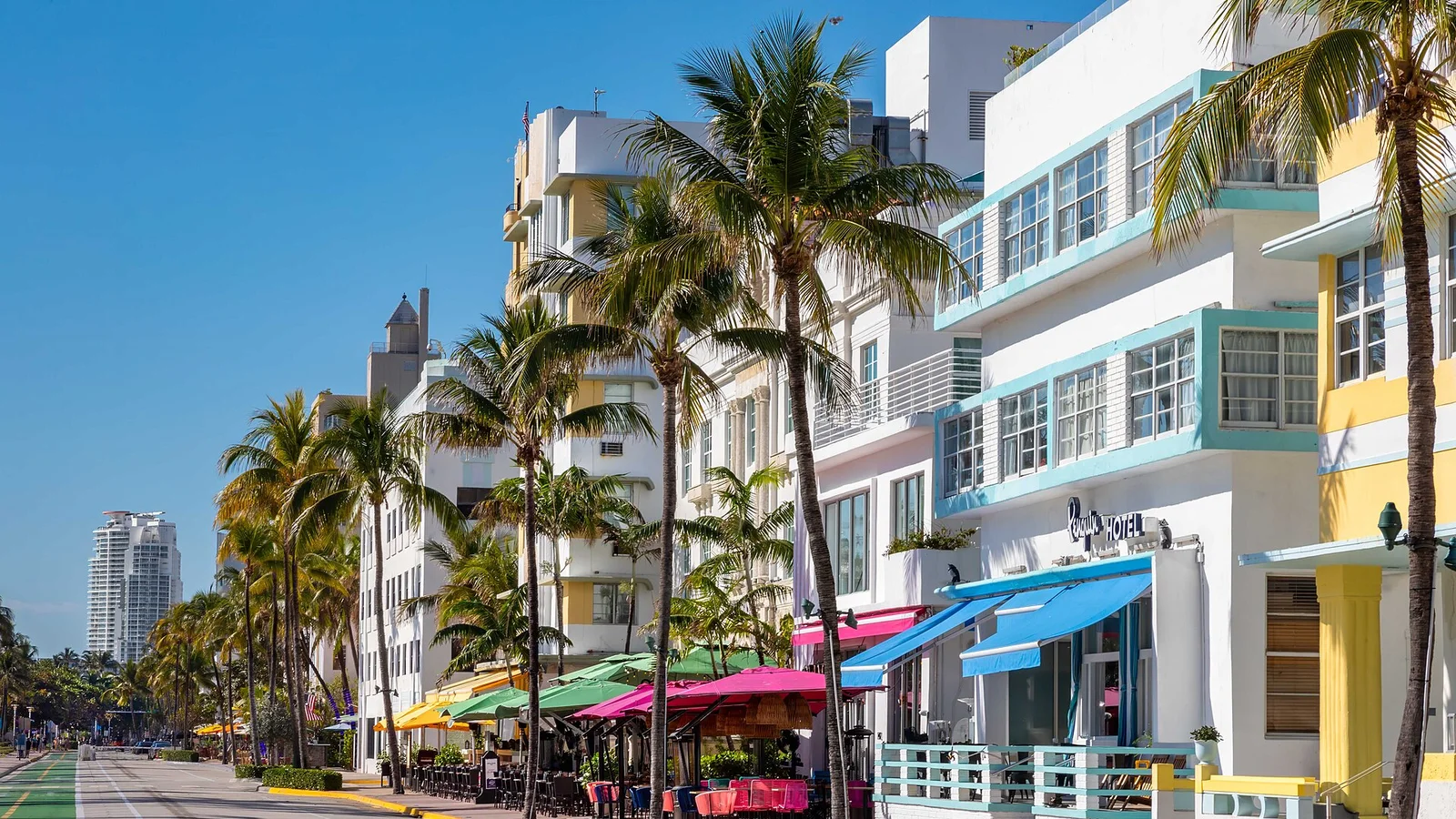
Stop 1: Ocean Drive, the postcard that looks made for GTA
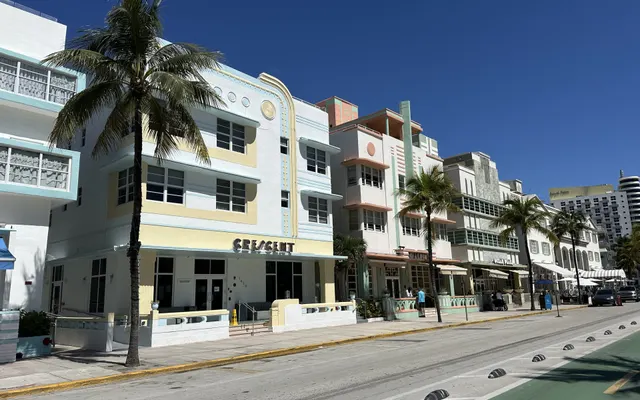
Start in South Beach, in Miami Beach, and walk Ocean Drive. Pastel facades, neon, palm trees and the beachfront promenade explain why this area fits Vice City so well. The Art Deco district runs roughly between 5th and 23rd Streets along Ocean Drive, Collins Avenue and Washington Avenue, and the local tourism office highlights its concentration of Art Deco buildings with Ocean Drive at its heart.
In the classic Vice City, Ocean Beach evokes South Beach, even if it isn’t an exact match. GTA 6 Trailer 1 shows the beach, low-rise hotels and the coastal avenue again: compare the mood with Ocean Drive, but don’t treat every shot as a real address. Local media have recognized buildings from the area. Go during the day for the facades, then come back at sunset to see how the street changes.
Look for the curved lines, porthole windows, awnings, signs and colors. The Art Deco Welcome Center and the Miami Design Preservation League tours give that architecture context. If you’re in a group, agree on a meeting point: everyone will stop to photograph a different detail.
Lummus Park, Muscle Beach and South Pointe
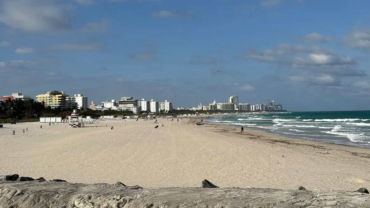
A few steps from Ocean Drive is Lummus Park, the linear park between the street and the sand: a good place to pause, look at the beach and remember how many GTA scenes mix sport, tourism and street chaos. Head south and South Pointe Park gives you another angle on the bay, the shipping channel and the boats. Muscle Beach, also in Miami Beach, has become a local spot to work out outdoors and has appeared in GTA VI promotion; that doesn’t make the whole park a game location, but it’s a nice extra for fans.
The beach is public, but check city rules on hours, access, safety and what you can bring. Don’t use the edge of the road or a bike lane as a viewpoint: the streets have traffic and cyclists. For night photos, stay in busy, well-lit areas and plan your ride back if you’re out late. The high-speed getaway works much better on a console than in a real city.
Little Havana: the real neighborhood behind Little Cuba
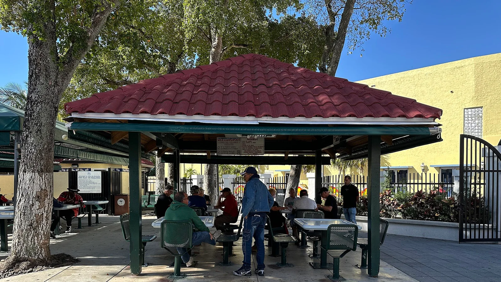
Calle Ocho changes the rhythm: Spanish, coffee windows, shops and domino games show another Miami. Máximo Gómez Park, or Domino Park, sits at the heart of Little Havana. It’s a living neighborhood, not a film set; the official Calle Ocho guide lists cultural spaces and points of interest.
Little Havana already appeared in Vice City (2002); in GTA 6, Rockstar uses the fictional name Little Cuba. The official People and Places page introduces that in-game district, while Calle Ocho gives you the real Cuban-American context. The official trailers show streets and city life, but they don’t confirm that a specific corner is a mission location.
Walk along the Calle Ocho Walk of Fame, look at the murals and, if you feel like it, order a cafecito at a ventanita. I won’t point you to one restaurant as “the authentic one” or invent a personal experience: there are many businesses, each with its own story. If you’re interested in Viernes Culturales, check the event’s site to see whether it matches your dates. Máximo Gómez Park is a shared space, so photograph it politely and don’t crowd the games or shoot close-ups of people without asking.
Wynwood: murals, warehouses and Vice City’s creative side
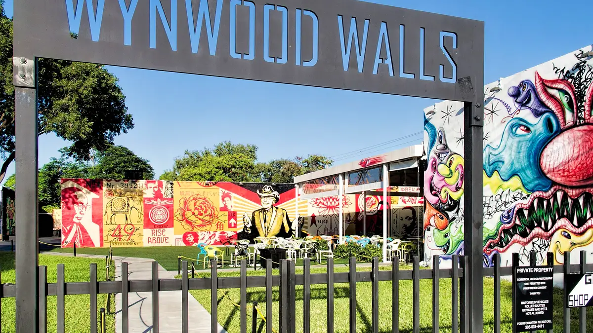
Wynwood brings together murals, galleries, studios, bars and old industrial buildings just north of downtown. Some works are visible from the street; others are inside venues with tickets or opening hours. The Wynwood Walls guide explains which part is a museum and what to see around it; respect businesses and homes as you walk.
On the classic map, Little Haiti has its own identity; for GTA 6, some outlets and fans link industrial areas such as Stockyard with Wynwood or Allapattah. It’s a visual reading, not an official match. When you watch the city shots in Trailer 2, look for murals and old warehouses and compare them with the local guide, without assuming an on-screen mural has a real address.
A simple plan is to come mid-morning or in the afternoon, walk the murals in good light and then pick somewhere for dinner. Check in advance whether a gallery charges entry and leave time to walk: the grid looks short on a map, but heat and photo stops stretch it. Wynwood pairs well with Downtown or Edgewater; I wouldn’t combine it with a full morning in the Everglades, which is a different direction and scale.
Downtown, Brickell and PortMiami: the skyscraper city
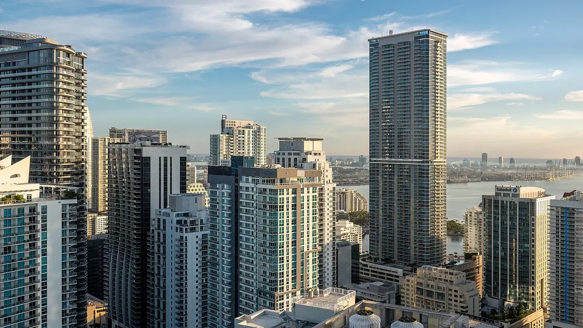
Downtown and Brickell are the Miami of towers, bridges and bay views. The skyline and waterfront shots in the GTA 6 trailers evoke this landscape, though they don’t identify every building. The Metromover, an elevated and free people mover, links part of downtown; check current stations and hours on the county’s site.
PortMiami sits on Dodge Island next to downtown and shows how much cruises matter to the city. Bay views change with the spot and what access is allowed. Don’t enter restricted terminals or piers; to get out on the water, pick a tour with a clear departure point and conditions.
In GTA: Vice City, Downtown and Vice Port are fictional areas that evoke the center and waterfront. Fans have compared current buildings with structures in the new game, but not every tower is a “confirmed easter egg”. The Pérez Art Museum Miami and Frost Science are good cultural alternatives; check hours and tickets before you go.
The bigger world of Leonida: the Everglades and the Florida Keys
GTA 6 doesn’t stop at Vice City: Rockstar sets the story in the fictional state of Leonida. In Trailer 1, the wetlands, birds and water recall the Everglades; the official site calls its swamp region Grassrivers. The Leonida places also feature the Leonida Keys, inspired by the Florida Keys. AP reported that Rockstar toured those regions, but the game condenses distances and locations.
The Everglades: the landscape behind Grassrivers
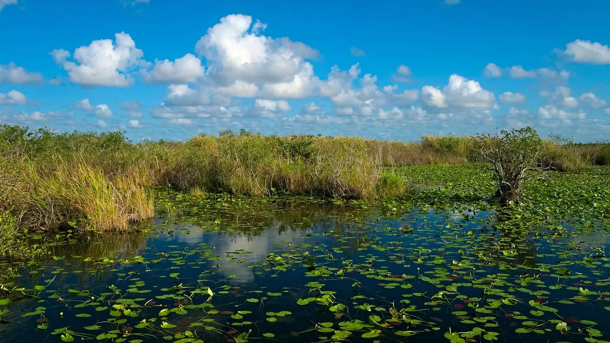
The Everglades is a protected national park of wetlands, mangroves, birds and alligators, with trails, visitor centers and several entrances; Shark Valley and the Tamiami Trail are common references from Miami. Work out the real drive time and check alerts and closures on the National Park Service site.
Airboat tours leave from different places and not all of them operate inside the park. Confirm the departure point, length, transport and rain policy. They can be very loud: follow the hearing-protection and wildlife guidance, never feed animals and keep your distance from alligators. For the park itself, don’t use the game’s map: it’s huge and its entrances aren’t interchangeable, so pick an official area and leave time to get back.
Grassrivers is the fictional mirror of the wetlands: in the trailer’s nature sequences, look out for the water, vegetation and birds. To visit the Everglades, don’t use the game map: the park is huge and its entrances aren’t interchangeable. Pick an official area and leave time to get back.
The Florida Keys: bridges, islands and the road south
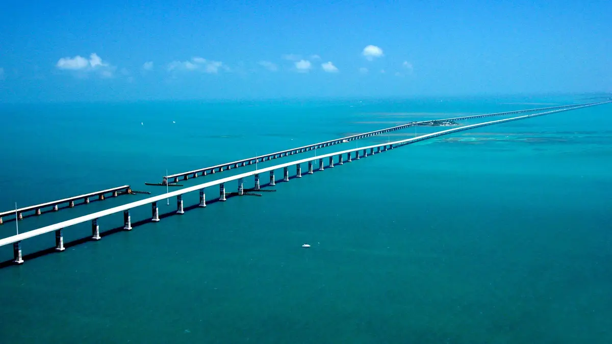
The Florida Keys are a chain of islands linked by the Overseas Highway and U.S. 1. The Seven Mile Bridge, near Marathon, is one of its best-known stretches. The bridges and islands in the Leonida Keys material point to this geography, but the game compresses it. Drive in authorized areas and plan real stops.
Key Largo is at the start of the chain; Key West is much farther south. From Miami the drive can take several hours each way depending on traffic and stops. I wouldn’t squeeze it in as a short trip between South Beach and Wynwood: add days or save Key West for another trip. Day tours save planning but take many hours, so check length, pickup, free time and what’s included. If you drive, share the wheel and the breaks: the bridges are roads with traffic, wind and rules, not viewpoints to stop on.
Day tours save you planning, but they take up many hours. Check the length, pickup, free time and what’s included. If you’re driving, share the shifts and breaks: the bridges are roads with traffic, wind and rules, not viewpoints to stop at wherever you like.
GTA fan route through Miami: how to split it over three days
The neighborhoods sit on both sides of the bay, so don’t plan as if everything were ten minutes apart. This route groups walks and transfers; for a general itinerary, see our Miami in 3 days guide.
Day 1: South Beach and Ocean Drive
- Morning: walk Ocean Drive and the Art Deco district, between 5th and 23rd Streets.
- Midday: Lummus Park and the beach; find shade and carry water.
- Afternoon: continue to South Pointe Park and rest before the evening.
- Evening: dinner nearby, with your ride back sorted in advance.
Day 2: Little Havana, Wynwood and Downtown
- Morning: Calle Ocho and Domino Park, unhurried; it’s a lived-in neighborhood, not a set.
- Next: Wynwood. Check the Wynwood Walls entry; other murals are visible from the street.
- Sunset: cross to Downtown and use the Metromover to reach Brickell if it suits you.
- Evening: eat near where you’re staying and avoid stacking timed bookings.
Day 3: the Everglades, the Keys or a slower Miami
- Nature: visit an accessible area of the Everglades or book a tour with a clear departure point. Bring water, sunscreen and repellent, and check official conditions.
- Road trip: head down to Key Largo or plan a multi-day route to Key West. Don’t try to turn the whole Keys into a quick stop.
- City: a museum, the bay, Coconut Grove or Key Biscayne, depending on what you’ve missed and the forecast.
If you fly out that day, choose the city option. With four or five days you can split the Everglades and the Keys; a week lets you explore Florida at a gentler pace. Check our best time to visit Miami guide before picking dates: heat, rain and hurricane season change the plan a lot.
With four days: add nature without rushing
Keep South Beach on day one and Little Havana–Wynwood–Downtown on day two. Spend the third day in the Everglades and the fourth on a stretch of the Keys, or book a night there if you want to reach Key West. Don’t try to do both landscapes in a single trip: the hours on the road eat up the visit.
Getting in from the airport and choosing a base
From Miami International Airport, Metrorail runs to downtown and the Route 150 Airport Express bus connects Airport Station with South Beach and Lincoln Road. Check the map and hours on Miami-Dade Transit. If you land late or carry lots of luggage, compare a direct transfer.
South Beach puts you next to Ocean Drive; Downtown and Brickell make the Metromover and museums easy. Our where to stay in Miami guide compares the areas. Look at location, late-night transport and parking, and for tours check whether they pick up at your hotel or you need to reach the meeting point.
Getting around without losing half the day in traffic
South Beach is easy on foot and the Metromover links part of Downtown and Brickell, but Wynwood, Little Havana, Miami Beach and the Everglades need transfers. Check schedules and compare rideshare, parking and a rental before deciding a car makes the trip simpler.
- South Beach: walk, and use the local trolley if it fits your route; check current city service.
- Downtown and Brickell: the free Metromover links several central areas. It’s for city hops, not for crossing Miami-Dade.
- Separate neighborhoods: time transfers by time of day. Wynwood and Little Havana aren’t next to the beach.
- Everglades and Keys: check tour departure points, distances, rental conditions and return time.
If you rent a car, check insurance, tolls, parking, deposits and extra drivers. In Miami Beach it may be worth leaving the car in a garage and using it only for day trips. You can cover many stops on foot and combine transit with the odd ride; no need to drive like Tommy down every street.
What it costs and how to book without surprises
There’s no single budget: flights, dates, rooms, taxes, resort fees, rentals and activities all move. Split flights, nights, transport, meals, tickets and a buffer for the unexpected, then agree as a group what’s shared and what each person pays. Miami can get pricier during big events and peak dates.
For flights, compare times, stops, baggage and airport, not just price: you can search flights to Miami on Trip.comAffiliate link: Youtopia may earn a commission if you book, at no extra cost to you.. South Beach is handy for walking to Ocean Drive; Downtown or Brickell suit you if you prioritize the Metromover and museums. You can search places to stay in Miami on Booking.comAffiliate link: Youtopia may earn a commission if you book, at no extra cost to you. or compare stays in Miami BeachAffiliate link: Youtopia may earn a commission if you book, at no extra cost to you.. Check the address, taxes, resort fees, cancellation and parking; Miami Beach and the City of Miami are different municipalities.
Miami Beach and the City of Miami are separate municipalities. Check the address, late-night transfers, taxes and the total cost; compare several rooms with an apartment and add up the fees.
Check language, length, transfers, tickets, cancellation policy and meeting point on each tour page.
Medical care in the United States can be very expensive, so travel with insurance that covers medical costs, and if you rent a car or do water tours, check what’s included. This is an affiliate link: compare cover and conditions before you buy.
An eSIM is optional: check that your phone supports it, how much data you get and whether your plan already covers the US. If you want a separate line, Saily gives 10% off with the code YOUTOPIA10 (affiliate link).
Fun details for seeing Miami through a fan’s eyes
- GTA VI brings Vice City into the present and extends the trip to Leonida; the official site groups cities, people and places under that fictional state.
- The Everglades and the Keys evoke Grassrivers and the Leonida Keys, even though the game compresses distances.
- AP reported that Rockstar toured Miami, the Keys and nearby towns and flew over the Everglades.
In a group, the list quickly turns into twenty ideas. In Youtopia you can vote on them, keep the bookings together and split the costs.
Don’t want to start from scratch? Copy our Miami in 3 days plan into your trip in Youtopia and swap the stops for this route: South Beach, Calle Ocho, Wynwood and the day trip you vote for.
Save the neighborhoods, vote on which day trip fits and split bookings and trip expenses in one shared space.
Try it freeTo set it up in Youtopia, create the trip and add one day for South Beach, one for Little Havana, Wynwood and Downtown, and optional days for the Everglades or the Keys. Add times, routes and bookings, vote on the day trips and decide who confirms schedules and budget.
Is it worth going to Miami just for GTA?
Miami is worth the trip if you like beaches, Art Deco, Latin culture and nature. Rockstar blends places together: Ocean Drive, Calle Ocho and the Florida behind Leonida make for a very fan-friendly getaway.
FAQ
Which real places inspired GTA 6’s Miami?
Vice City and Leonida are fictional. South Beach, Miami and the landscapes of the Keys and the Everglades are clear inspirations; specific buildings are usually identifications by the press or fans.
Is Vice City based on Miami?
Yes. Vice City is inspired by Miami, but its 2002 map and districts are fictional and don’t match real scale.
How many days do I need to see the GTA places in Miami?
Three days cover South Beach, Little Havana, Wynwood and Downtown. Add time for the Everglades or the Keys; Key West isn’t a quick stop.
Are there GTA tours in Miami?
There are architecture walks and tours of South Beach, Little Havana and the Everglades. Check whether the itinerary includes the places you care about.
Sources checked on November 18, 2026: Rockstar, AP, the classic game’s official manual map, Greater Miami & Miami Beach, Miami-Dade Transit and the NPS.
Questions or a place I missed? Email me at hola@getyoutopia.app. — Kevin
Near Miami
If you have a spare day or want to combine two places in one trip.
Plans you can copy ready for your trip.
Day-by-day itineraries from our guides, with the route for each day, times and prices. Copy them into the app and change them together.
 Miami3 days · from 2 to 4
 Cancún4 days · from 3 to 5
 New York5 days · from 4 to 7
 Mexico City4 days · from 3 to 5
 Las Vegas3 days · from 2 to 4
 Lisbon3 days · from 2 to 5
 Porto3 days · from 2 to 4

Pick the type of trip, the pace and the budget, and Yupi builds the plan with real places. Then you vote and log the expenses. Free.
Photo credits
Cover: Wilfredor (16:9 crop, converted to WebP) · Wikimedia Commons (CC0 1.0)
Ocean Drive, Miami Beach: Robbschultz69 (16:9 crop, converted to WebP) · Wikimedia Commons (CC BY-SA 4.0)
South Pointe Park, Miami Beach: Dough4872 · Wikimedia Commons (CC BY-SA 4.0)
Little Havana, Miami: Phillip Pessar (16:9 crop, converted to WebP) · Wikimedia Commons (CC BY 2.0)
Wynwood Walls, Miami: Dan Lundberg · Wikimedia Commons (CC BY-SA 2.0)
Brickell, Miami: Rhododendrites · Wikimedia Commons (CC BY-SA 4.0)
Anhinga Trail, Everglades: Daniel Kraft · Wikimedia Commons (CC BY-SA 3.0)
Seven Mile Bridge, Florida Keys: United States Department of Transportation · Wikimedia Commons (Public domain)